A DANGEROUS weather bomb poised to smash Britain this weekend threatens worse carnage than Ophelia’s assault on Monday.
Trees and structures weakened by 90mph gales at the start of the week could topple when ‘Storm Brian’ hits on Saturday.
Unlike Ophelia, which vented much of her fury across Ireland and the southwest, the next storm has the entire country in its sights.
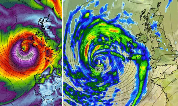
Warnings have been ramped up as forecasters watch the progress of a powerful low-pressure system currently churning the Atlantic.
The Met Office this morning confirmed the storm will go through an “explosive” development as it passes over ocean waters.
An expected fall of 24 millibars in 24 hours will give the system enough fury to warrant the term “explosive cyclogenesis” or “weather bomb”.
Similar to Monday’s storm it threatens to whip up near hurricane-force gales hurling monster waves over sea defences.
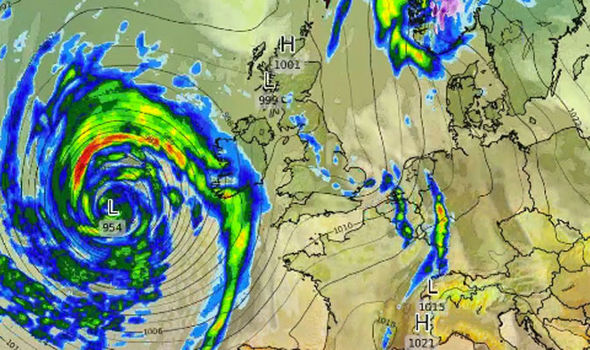
Latest models show the tempest hitting the southwest coast at around 9am on Saturday before ripping through the country during the day.
Dave Reynolds, forecaster for The Weather Company, said: “This storm is going to be large enough to affect the whole of the UK.
“The low-pressure system is forecast to come in from the southwest before moving across the centre of the country.
“We expect winds of 80mph perhaps stronger in coastal regions and although these might not be as strong as Ophelia it is important to note that many trees may have been weakened earlier in the week.
“The next storm, which potentially could be named ‘Brian’ may uproot trees which survived Ophelia on Monday.”
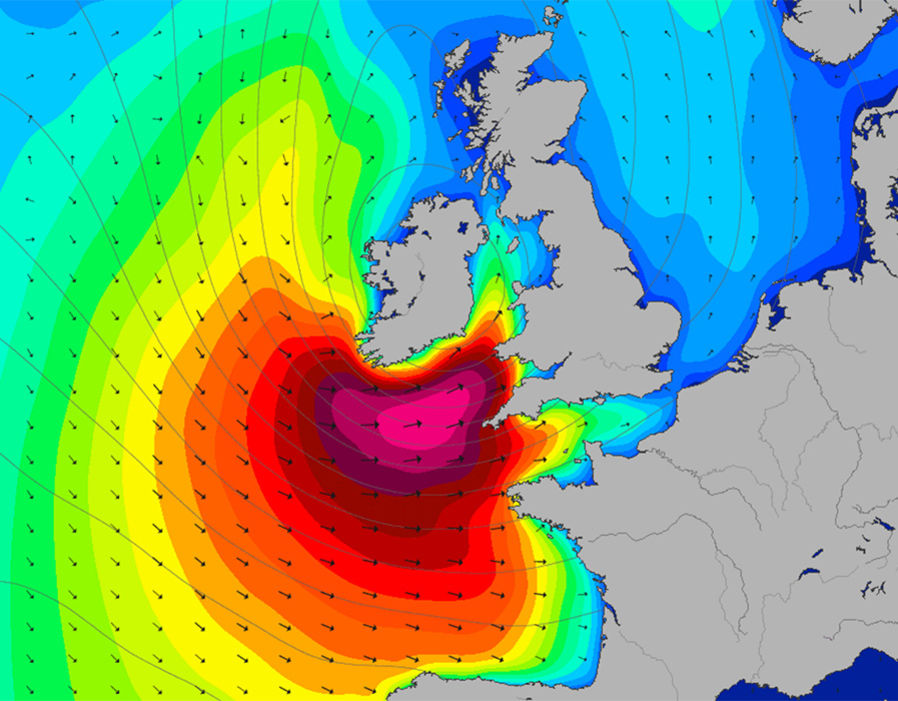
Western and southwestern coastal regions are braced fro 40ft waves to tumble over defences triggering floods.
The Government has issued warnings for wind across southern and western England between 4am and midnight Saturday.
It warns to brace for “dangerous conditions” triggering disruption to air and ferry routes, flooding and power outages.
The Met Office said winds will start to pick up on Friday night before sweeping he nation through Saturday.
It has warned Britons to batten down the hatches as powerful winds coincide with high tides whipping up monster waves.
Forecaster Oli Claydon said: “Strong winds will pick up on Friday evening and rain will push northeastwards.
“Winds will strengthen overnight into Saturday and then through the day most of the UK will have a very unsettled period of weather.
“This low pressure system will deepen over the Atlantic and we are seeing a drop of 24millibars in 24 hours so the does qualify as explosive cyclogenesis.
“The strongest winds will be across South Wales and southwest England but as this is quite a big low-pressure system much of the country will be unsettled.
“It is going to be pretty autumnal through Thursday also as a smaller low comes in."
Met Office chief forecaster Frank Saunders said: “An intense low pressure system is expected to bring a swathe of strong southwesterly winds over southern areas early on Saturday, these steadily transferring east through the morning and early afternoon, becoming westerly and eventually northwesterly later whilst also slowly easing.
“Gusts exceeding 50 mph are expected widely within the warning area.
“These are expected to coincide with high tides, leading to locally dangerous conditions.
“Some coastal routes and communities are likely to be affected by large waves, with potential for flooding of properties.
“Some transport disruption is likely across the warning area, with delays to road, rail, air and ferry transport.
“Short term loss of power and other services is also possible.”