GREECE has been rocked by a 4.3 magnitude earthquake and 4.4 magnitude earthquake just one hour apart but where exactly in the country did the tremors strike?
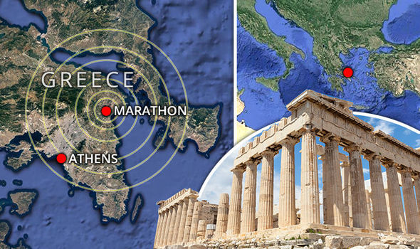
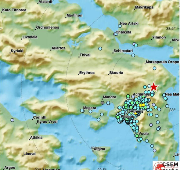
The first earthquake to rattle Greece hit 25km (15 miles) northeast of Athens at 8.24pm GMT on Monday, with tremors being felt “widely across” the capital.
A data map from the US Geological Survey (USGS) pinpointed the location as 4km west-northwest of Marathon, Greece - the site of the ancient battle of Marathon in East Attica.
Residents in Athens, home to a population of 3.75 million people in the metropolitan area, reported the quake as “strong” but quick with car alarms being set off.
Journalist Patrick Osgood tweeted: "Just had the whole apartment wobble a bit in Athens in an earthquake tremor”.
Another journalist, Yanni Koutsomitis, tweeted: “Strong #earthquake felt in Athens two minutes ago. #Greece”
Fire brigade officials said there were no immediate reports of damage or injuries.
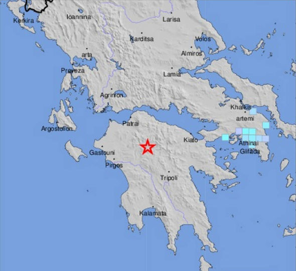
UGCS maps also showed a second separate 4.4 magnitude earthquake hit the Peloponnese region one hour earlier, 51 km (30 miles) south-southeast of Patras.
Patras is Greece’s third-largest city and the regional capital of Western Greece in the north of Peloponnese.
"Residents should remain calm," he said. "The data is in our favour.”
Greece is prone to earthquakes and a 5.9 magnitude quake near Athens in 199 killed 143 people.
The country sits on a number of fault lines in the eastern Mediterranean between the African Plate and the Eurasian Plate.