HURRICANE Ophelia is on track to hit the UK and Ireland within the next 48 hours, but where is it now?
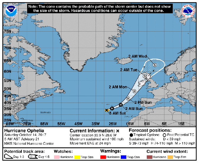
Where is Hurricane Ophelia now? The most recent update from the NOAA at 4pm BST located Hurricane Ophelia about 220 miles south-southwest of the Azores.
The storm has strengthened and is now a major category 3 hurricane with winds of 115mph – the most easternmost storm ever to achieve such intensity.
Ophelia will be a post-tropical cyclone by the time it reaches the UK and Ireland but will likely still have winds nearing hurricane strength.
The NOAA said:“ Ophelia is expected to be a powerful extratropical cyclone with hurricane force winds Monday while it moves near Ireland and the United Kingdom.
“Direct impacts from wind and heavy rain in portions of these areas are likely, along with dangerous marine conditions.”
When will Hurricane Ophelia hit the UK and Ireland?
The NOAA’s latest map shows Ophelia’s path reaching Ireland after 7am on Monday morning, moving on to Scotland by 7am on Tuesday morning.
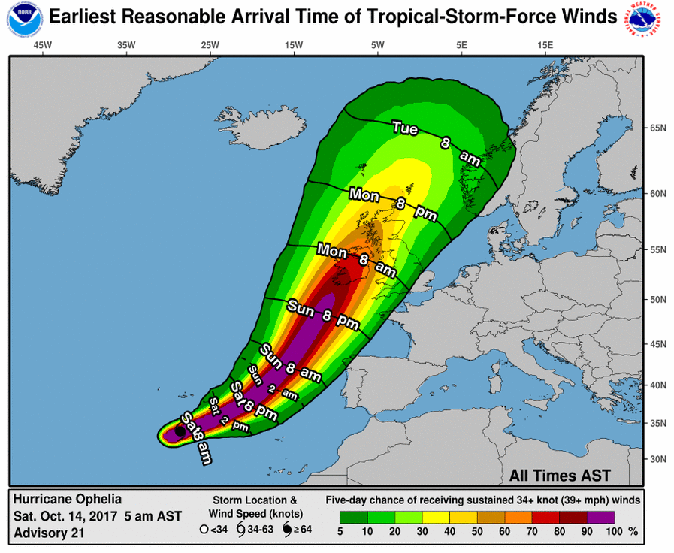
Heavy winds nearing hurricane strength are forecast to batter the British Isles as the storm approaches.
The Met Office has issued a yellow weather warning for the west coast of Britain and Northern Ireland from 12pm until 11.55pm on Monday, with winds of up to 80mph expected.
Strong winds could create chaos with power outages, damage to buildings and impact on transport links.
Met Office chief forecaster Steve Ramsdale said: “Understandably, there is a lot of public concern about the potential impacts of ex-Ophelia.
“In readiness, we have already issued Yellow wind warnings for Northern Ireland and parts of western and northern Britain for Monday and Tuesday, suggesting wind gusts possibly reaching up to 80mph in places.”
While the west faces extreme weather conditions, the east of England will enjoy temperatures in the mid 20s due to tropical air being brought in by the hurricane.
“Although parts of the UK may experience severe conditions, it’s important to realise that not all areas will be affected by this ex-hurricane,” Mr Ramsdale said.
“For example, much of eastern England will be unusually warm for the time of year but quite breezy on Monday and Tuesday.”
In Ireland, a red wind warning (the highest level possible) has been issued for Galway, Mayo, Clare, Cork and Kerry from Monday 9am until Tuesday 3am.
Met Éirann said: “Mean wind speeds in excess of 80 km/h and gusts in excess of 130km/h are expected, potentially causing structural damage and disruption, with dangerous marine conditions due to high seas and potential flooding.”