BRITAIN is facing one of the worst storms for almost a decade with tropical tempest Ophelia set to smash the country next week.
Gales and torrential downpours unleashed by the potent weather system threaten swathes of the UK from Monday evening.
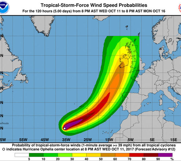
Ophelia is currently whipping up wind speeds of almost 70mph as she hurtles across the Atlantic towards the north coast of Spain.
She is showing signs of changing track and hitting the UK just after the weekend - almost 30 years to the day since the Great Storm of 1987.
While the impact is not expected to be as severe, forecasters say Ophelia will be similar to Tropical Storm Grace which hit Britain 2009 and ex-hurricane Gordon which struck in 2006.
Both unleashed powerful gales across the country with winds of more than 80mph recorded in the worst-hit regions.
Unlike many tropical storms and hurricanes which cross the Atlantic, Ophelia will not break down before she arrives.
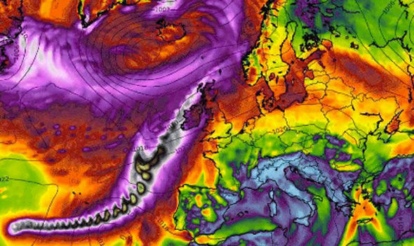
Instead she will remain as a wholly intact low-pressure system reaching UK shores fully charged and with a mighty sting in her tail.
The weather will start to turn unsettled late on Monday as Ophelia slams into the west coast of Britain, experts say.
Models currently vary on the exact path of the storm however they all agree the UK could suffer significant impact through Tuesday.
Met Office spokesman Grahame Madge said: “We are expecting conditions to turn unsettled at the start of next week.
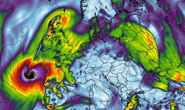
“Later on Monday there is a suggestion that a low-pressure system derived from Ophelia will arrive off the southwest coast of Ireland; that is likely to bring wet and windy conditions to Britain.
“Its effect will depend on the track and there are several variations at present, some show it following a central path across the British Isles while others show it heading further north.”
Met Office meteorologist, Aidan McGivern, said the weather service was “very concerned” and were monitoring the progress of Ophelia.
Britain is in the firing line for a “very wet and windy” spell of autumn weather if Ophelia makes a direct hit, he warned.
He added: “While a tropical system heading our way like this is not unprecedented, it is unusual.
“It is expected to retain the integrity of the original storm rather than dissipating into a warm air mass, in terms of any name, it will be called ex-tropical storm Ophelia.
“Tropical Storm Grace which affected the British Isles in 2009 was similar as was Hurricane Gordon which affected the UK in 2006.
“Both of these brought strong winds to the UK.
“It is likely to be very wet and windy if the central projection is correct [Ophelia tracks directly across the country], it is still a way off at the moment though.
“It will have an effect on Monday and through Tuesday, but is looking short-lived so things should turn more settled towards mid-week.”
Ophelia will arrive almost 30 years to the day since the historic Great Storm struck on the night of October 15, 1987.
The violent extratropical cyclone brought hurricane-strength winds to the UK killing 22 people and bringing widespread destruction.
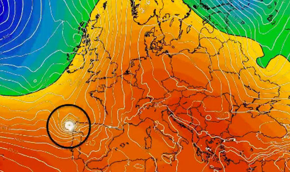
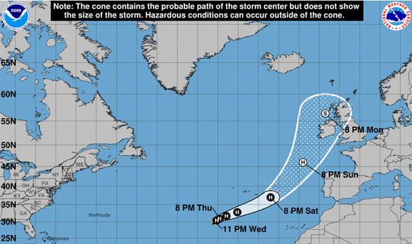
Tropical Storm Ophelia is currently churning ocean waters off the west coast of North Africa and is expected to reach northern Spain during the early hours of Monday.
It is travelling northeastwards with sustained winds of 65mph although warm sea waters threaten to pump more energy into the system.
The US National Hurricane Centre (NHC) warned the storm is still strengthening and could become a fully-fledged hurricane over the next couple of days.
In a statement it said: “Ophelia has become better organised during the past several hours, with convective banding now wrapping almost all of the way around the centre.
“The cyclone is forecast to turn northeastward and accelerate ahead of a deepening mid-latitude trough over the north-central Atlantic.
“The cyclone is expected to be within a low shear environment and over marginally warm sea
surface temperatures during the next two to three days.
“These conditions favour strengthening and the NHC forecast now calls for Ophelia to become a hurricane in about 24 hours.”
Claire Kennedy-Edwards, senior meteorologist with The Weather Company, said: “Although there is still some uncertainty about the track of Ophelia models are coming into agreement that Ophelia will become a deep low pressure system during Monday morning as it approaches southwest Ireland with some stormy conditions expected.
“By Tuesday the strongest winds are expected to be across Western Scotland with gusts around 55 to 60 mph.
“Moderate rain [will affect] eastern Ireland as well as parts of Wales into southwestern UK.
“It is important to stress that this track is likely to change and people should pay attention to further updates in subsequent days.”